A few years before French inventor Louis Daguerre ushered in the age of photography in Paris, a talented young artist and explorer called Frederic Dubois arrived in the Caucasus in 1831 with a sketch pad and an epic mission ahead of him.
Dubois, a Swiss-Prussian nobleman, had received the blessing of the Russian Tsar Nicholas I to explore and draw the mountainous southern frontier of the Russian Empire. That region is today’s Armenia, Georgia, and Azerbaijan.
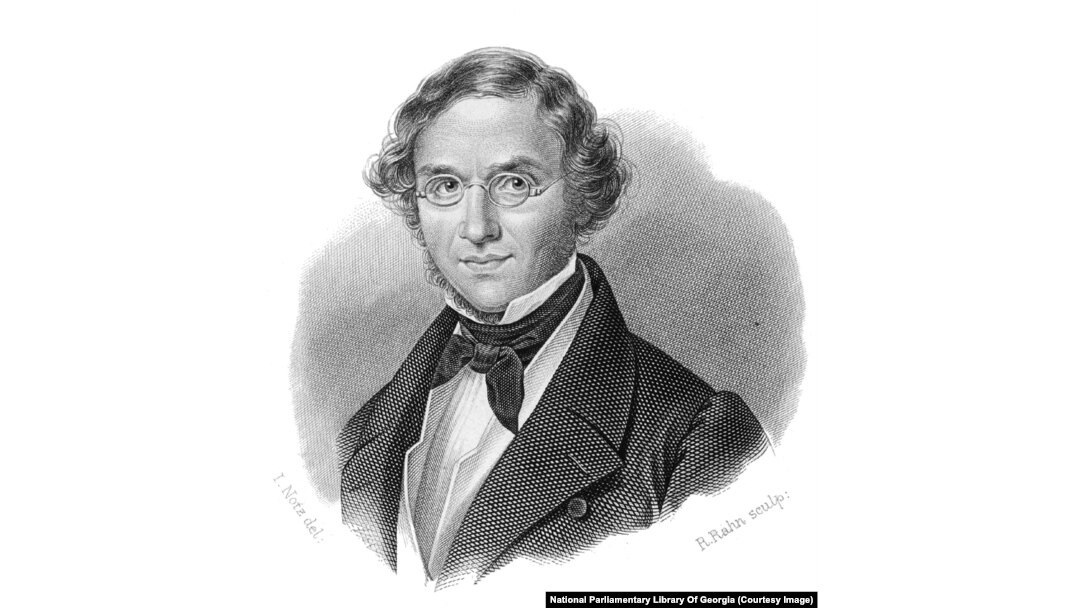
Frederic Dubois (1798-1850) was a French-speaker from Neuchatel, in today’s Switzerland. In addition to the Caucasus, Dubois also traveled widely in Crimea.
Little is known about most of Dubois’s life. But during the three years he spent traveling the Caucasus -- sometimes accused of being a spy -- he was so prolific with his pencil and sketch pads that he returned to Europe with enough material for a travelogue that filled 11 volumes. That included five giant “atlases” full of illustrations.
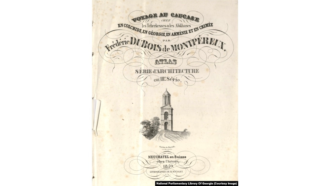
A title page of one of the volumes provided to RFE/RL by the National Parliamentary Library Of Georgia
Dubois’s books today are extremely rare and closely guarded. In 2017, a full collection of his Caucasus travelogue sold at auction for more than $154,000. Three volumes of the atlases are reported to be held in Russian museums, and one volume, with a mysterious backstory, is held in a small library in Georgia’s breakaway region of Abkhazia.
After several dead ends, RFE/RL was able to acquire scans of three of the atlases from the National Parliamentary Library Of Georgia. Thanks to the staff there, these fascinating images of the Caucasus as it looked nearly 200 years ago can be published in crystal-clear quality.
*Locations are given according to current borders in the Caucasus.
A view from Yerevan’s fortress toward the Ararat Plain and the distant Mount Ararat. Today a brandy factory stands in place of the ruined fortress where Dubois stood to sketch this landscape.
Two men at the base of the Shamkir Minaret in Azerbaijan. The structure, which collapsed into rubble sometime before 1861, was reportedly 60 meters tall. It is believed to have served as a military watchtower and was built around the 11th century.
Structures described by Dubois as “Persian” in Azerbaijan’s exclave of Naxcivan. In the background, the “pyramids of Mount Ararat rise majestically.” The explorer noted that “since I made my trip to [Naxcivan], a terrible earthquake on June 20, 1840, brought down these two monuments. They now exist only in my drawings."
Armenia’s Geghard Monastery, loosely framed amid its craggy landscape. Dubois called the site "one of the wildest valleys of greater Armenia," noting that the lonely monastery “appealed to hermit monks who have renounced the world.” Dubois claimed that the monks of the site guarded both the tip of the Roman spear used to prod Jesus “and a piece of Noah’s ark.”
The Pitsunda Cathedral, in Georgia’s breakaway region of Abkhazia. The young artist noted that the Russian Tsar Nicholas I had ordered the crumbling church to be restored but “I drew it as it was before being repaired. The roof is falling apart and the dome is covered in pomegranate trees.”
A view over the ruined city of Julfa in Naxcivan. Armenian researcher Simon Maghakyan, who has studied this area extensively, told RFE/RL the sketch appears to have been made from the edge of the famous Armenian cemetery in Julfa, which was demolished by Azerbaijan’s military in 2005.
Maghakyan speculates that even the tireless Dubois may have been overwhelmed with the amount of detail he would need to sketch if he included more of the intricately carved cross-stones, known as khachkars.
“What the artist has done is to show only one khachkar out of several thousand, in order to help the viewer appreciate it most,” Maghakyan says. “It must have been an exhausting experience to stand in the middle of the world’s largest forest of khachkars and attempt sketching it.”
A detailed drawing of one of the stone rams from the Julfa cemetery that marked some graves. Only a few of the mysterious stone animals still exist.
The ruins of Bagrati Cathedral in the western Georgian city of Kutaisi. The building “was devastated in 1691 by the Turks,” Dubois wrote, “who blew up the fortress and surrounding buildings.”
Dubois describes the cathedral as “a mixture of Byzantine and Armenian [styles].”
In a summary that may irk some Georgian readers, the artist claimed: “The Byzantine style was adopted for the interior, while the exterior decorations were rather an imitation of the Armenian style.”
Another angle of the Bagrati Cathedral. Today the structure would barely be recognizable for Dubois. The landmark has been completely rebuilt and rises prominently from a central hill above Kutaisi.
A view of the Nagorno-Karabakh region with the towering cliffs of Susa/Shushi pictured in the background. This area has been the scene of deadly fighting between Azerbaijani and ethnic Armenian forces, including during an intense escalation in 2020 between the two countries.
A bridge over the Debed River, which today marks some of the border between Georgia and Armenia.
Dubois seems to have been highly taken by the sturdy bridge, describing its “two balconies suspended over the river” making it possible to “enjoy the freshness of the current.”
“Before, there was a village set up there by the king so travelers could find food,” the explorer wrote. "Today, nothing stands, no village, no caravanserai. The bridge alone remains. Its length is 400 feet, its width 14 feet.”
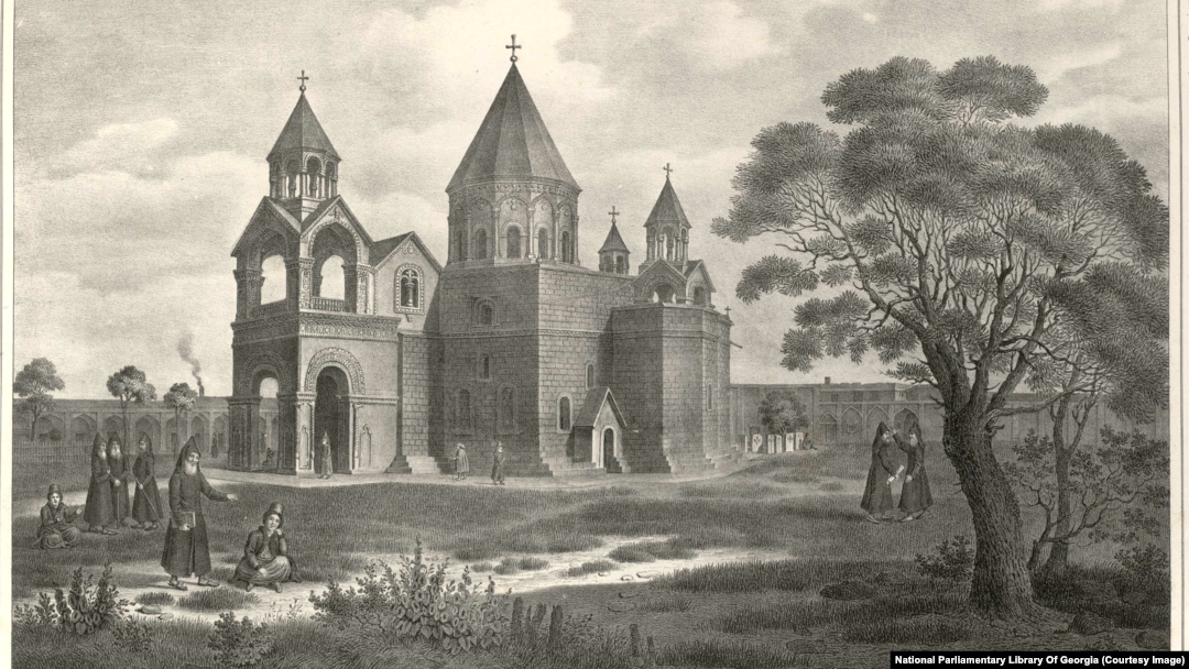
Armenian monks in hooded robes chat on the grounds of the Etchmiadzin Cathedral, around 20 kilometers west of Yerevan. The structure is unchanged today and is considered by many historians to be the oldest cathedral in the world.
A church in Akhaltsikhe, in the south of Georgia
“I close the series of Armenian-style monuments with the Armenian church, which was built at the top of the city of Akhaltsikhe, on the point which was most strongly defended by the Turks during the capture of the city in 1828," Dubois wrote. "The holes that can be seen in the cornices and walls were made by cannonballs during the siege of the city.”
Dubois returned to Europe in 1834. After his books on the region were published, he received a gold medal of the French Geographical Society and the Order of St. Stanislaus. He was also gifted a large sum of money from the Russian tsar. His final years were spent on archaeological research in Europe. He died in 1850, aged 51.